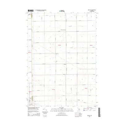
2014 Map of Ovid East
USGS Topo · Published 2014About this map
Agricultural lands at the convergence of Clinton, Shiawassee, and Gratiot counties define this landscape. The settlement of Ovid occupies the southwestern corner, while smaller rural junctions like Carland, Burton, and Hoovers Corners anchor the surrounding townships. The terrain is defined by a dense network of managed waterways, including Baker Cr, Lamb Cr, and David Drain, reflecting the region's long history of drainage improvements for productive farming. This 2014 survey serves as a modern record of land ownership and cemetery locations, preserving the sites of Old Fairfield Cem, Fairfield Cem, and Maple Grove Cem within the grid of section roads. The map's layout demonstrates the enduring geometry of the Public Land Survey System, with roads like W Juddville Rd and Mason Rd following the township and range lines established during early settlement.
Find a feature on this map
40 named features on this map. Tap any name to fly to it.
Don’t see what you’re looking for? This feature index may not catch every label — zoom into the map to look around manually.
Map Details
Editions of this 2014 Ovid East Map
This is the sole edition of this map. No revisions or reprints were ever made.
Other maps of this area

1917 · Chesaning
USGS Topo · 1:62,500

1918 · Elsie
USGS Topo · 1:62,500

1926 · Corunna
USGS Topo · 1:62,500

1928 · Laingsburg
USGS Topo · 1:62,500

1929 · Corunna
USGS Topo · 1:62,500

1943 · Chesaning
USGS Topo · 1:62,500

1943 · Elsie
USGS Topo · 1:62,500

1944 · Laingsburg
USGS Topo · 1:62,500

1944 · Corunna
USGS Topo · 1:62,500

1954 · Midland
USGS Topo · 1:250,000