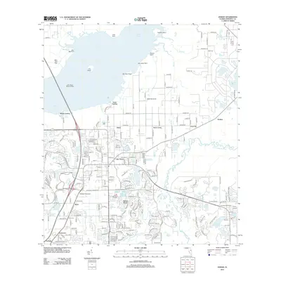
2012 Map of Oviedo
USGS Topo · Published 2012About this map
Lake Jesup dominates the northern landscape of this Florida region, where the intricate shoreline includes features like Big Gator Point and Little Gator Point. The transition from the water to the developed interior is marked by the Lake Jesup Seaplane Base and Whites Landing, indicating a community deeply connected to its aquatic environment. Further inland, the settlement patterns of Slavia and Lake Charm show the evolution of Seminole County from its agricultural roots toward modern residential growth, evidenced by developments like Alafaya Woods.
Find a feature on this map
86 named features on this map. Tap any name to fly to it.
Don’t see what you’re looking for? This feature index may not catch every label — zoom into the map to look around manually.
Map Details
Editions of this 2012 Oviedo Map
This is the sole edition of this map. No revisions or reprints were ever made.
Other maps of this area

1949 · Osceola
USGS Topo · 1:24,000

1953 · Geneva
USGS Topo · 1:24,000

1953 · Oviedo SW
USGS Topo · 1:24,000

1953 · Bithlo
USGS Topo · 1:24,000

1955 · Orlando
USGS Topo · 1:250,000

1956 · Oviedo
USGS Topo · 1:24,000

1956 · Orlando East
USGS Topo · 1:24,000

1957 · Orlando
USGS Topo · 1:250,000

1958 · Orlando
USGS Topo · 1:250,000

1962 · Orlando
USGS Topo · 1:250,000