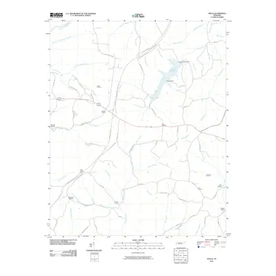
2010 Map of Ovilla
USGS Topo · Published 2010About this map
Laurel Hill Lake and its accompanying Laurel Hill Lake Dam anchor the northern landscape of this Wayne County region, where the Natchez Trace Pkwy cuts a modern path through traditional family lands. The terrain is defined by a dense network of creek valleys and hollows, including Murphy Hollow and Kilburn Hollow, which have long shaped the settlement patterns of the area.
Find a feature on this map
80 named features on this map. Tap any name to fly to it.
Don’t see what you’re looking for? This feature index may not catch every label — zoom into the map to look around manually.
Map Details
Editions of this 2010 Ovilla Map
This is the sole edition of this map. No revisions or reprints were ever made.
Other maps of this area

1905 · Waynesboro
USGS Topo · 1:125,000

1936 · Riverside
USGS Topo · 1:24,000

1936 · Westpoint
USGS Topo · 1:24,000

1936 · Deerfield
USGS Topo · 1:24,000

1936 · Collinwood
USGS Topo · 1:24,000

1936 · Henryville
USGS Topo · 1:24,000

1936 · Negro Hollow
USGS Topo · 1:24,000

1936 · Long Branch
USGS Topo · 1:24,000

1936 · Topsy
USGS Topo · 1:24,000

1936 · Ovilla
USGS Topo · 1:24,000