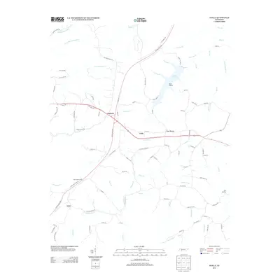
2013 Map of Ovilla
USGS Topo · Published 2013About this map
Highland and Ovilla serve as central points in this portion of Wayne County, where modern transport corridors meet historical routes. The Natchez Trace Pkwy arcs across the landscape, intersecting with local thoroughfares like Old State Hwy 15 and Old Chisholm Rd, the latter hinting at the area's deep-rooted transit history. The terrain is defined by a dense network of watercourses, including Little Fortyeight Cr and the Little Buffalo River, which carve through the land near Buttermilk Ridge. Local landmarks such as the Ovilla Lookout Tower and the sprawling Laurel Hill Lake underscore a landscape managed for both utility and recreation. Smaller settlements like New Haven and uniquely named locations like Dogwood Mudhole provide specific points of interest for those tracing the community footprint of this Tennessee Highland Rim region.
Find a feature on this map
99 named features on this map. Tap any name to fly to it.
Don’t see what you’re looking for? This feature index may not catch every label — zoom into the map to look around manually.
Map Details
Editions of this 2013 Ovilla Map
This is the sole edition of this map. No revisions or reprints were ever made.
Other maps of this area

1905 · Waynesboro
USGS Topo · 1:125,000

1936 · Riverside
USGS Topo · 1:24,000

1936 · Westpoint
USGS Topo · 1:24,000

1936 · Deerfield
USGS Topo · 1:24,000

1936 · Collinwood
USGS Topo · 1:24,000

1936 · Henryville
USGS Topo · 1:24,000

1936 · Negro Hollow
USGS Topo · 1:24,000

1936 · Long Branch
USGS Topo · 1:24,000

1936 · Topsy
USGS Topo · 1:24,000

1936 · Ovilla
USGS Topo · 1:24,000