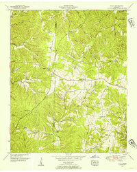
1951 Map of Ovilla
USGS Topo · Published 1954About this map
Ovilla serves as a central point in this mid-century survey of the rugged borderlands between Wayne and Lawrence counties. The landscape is defined by a dense network of hollows and ridges, with the Buffalo River cutting through the northeast corner and the historic Natchez Trace Parkway arcing across the northern terrain. This era of Tennessee's rural development is recorded through its scattered local institutions, from the New Haven Ch and Unity Ch to educational landmarks like the County Line School and Fish trap School.
Find a feature on this map
57 named features on this map. Tap any name to fly to it.
Don’t see what you’re looking for? This feature index may not catch every label — zoom into the map to look around manually.
Map Details
Editions of this 1951 Ovilla Map
2 editions found
Other maps of this area

1905 · Waynesboro
USGS Topo · 1:125,000

1936 · Riverside
USGS Topo · 1:24,000

1936 · Westpoint
USGS Topo · 1:24,000

1936 · Deerfield
USGS Topo · 1:24,000

1936 · Collinwood
USGS Topo · 1:24,000

1936 · Henryville
USGS Topo · 1:24,000

1936 · Negro Hollow
USGS Topo · 1:24,000

1936 · Long Branch
USGS Topo · 1:24,000

1936 · Topsy
USGS Topo · 1:24,000

1936 · Ovilla
USGS Topo · 1:24,000