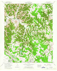
1962 Map of Ovoca
USGS Topo · Published 1965About this map
The Duck River winds through a landscape of deep hollows and ridges in this early 1960s survey, illustrating the geographical split between industrial growth and agricultural heritage. To the south, the expansion of Tullahoma is evident through newly platted residential areas like Tullahoma Estates and Homeway Village. The presence of the Arnold Engineering Development Center (U S Air Force) and its surrounding Wildlife Management Area highlights the mid-century military and technological footprint in the region.
Find a feature on this map
62 named features on this map. Tap any name to fly to it.
Don’t see what you’re looking for? This feature index may not catch every label — zoom into the map to look around manually.
Map Details
Editions of this 1962 Ovoca Map
This is the sole edition of this map. No revisions or reprints were ever made.
Other maps of this area

1913 · Hollow Springs
USGS Topo · 1:62,500

1936 · Ovoca
USGS Topo · 1:24,000

1936 · Fredonia
USGS Topo · 1:24,000

1936 · Manchester
USGS Topo · 1:24,000

1936 · Cumberland Springs
USGS Topo · 1:24,000

1936 · Noah
USGS Topo · 1:24,000

1936 · Wartrace
USGS Topo · 1:24,000

1936 · Camp Peay
USGS Topo · 1:24,000

1936 · Capitol Hill
USGS Topo · 1:24,000

1936 · Normandy
USGS Topo · 1:24,000