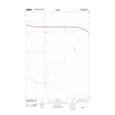
2012 Map of Owanka
USGS Topo · Published 2012About this map
Owanka stands as a focal point in this Pennington County landscape, situated where Owanka Rd meets the winding course of Boxelder Creek. This western South Dakota prairie terrain is defined by a sparse but deliberate network of section-line roads and natural drainages like Patterson Creek and the notable Madison Draw. To the north, the small settlement of Wicksville sits along Hwy-1416, serving as a waypoint for travelers across the plains. The presence of the Owanka Cem near the townsite offers a tangible link for genealogists researching the families who settled this region. The map illustrates a ranching and rural residential pattern typical of the early 21st century, where modern infrastructure such as Interstate 90 intersects with older township corridors like 227th St and 232nd St.
Find a feature on this map
15 named features on this map. Tap any name to fly to it.
Don’t see what you’re looking for? This feature index may not catch every label — zoom into the map to look around manually.
Map Details
Editions of this 2012 Owanka Map
This is the sole edition of this map. No revisions or reprints were ever made.
Other maps of this area

1953 · Rapid City
USGS Topo · 1:250,000

1954 · Wasta
USGS Topo · 1:24,000

1954 · Owanka
USGS Topo · 1:24,000

1954 · Creston
USGS Topo · 1:24,000

1954 · Wasta NW
USGS Topo · 1:24,000

1954 · Brennan Flat
USGS Topo · 1:24,000

1954 · Quinn Table
USGS Topo · 1:24,000

1955 · Hot Springs
USGS Topo · 1:250,000

1957 · Rapid City
USGS Topo · 1:250,000
1957 · Owanka NE
USGS Topo · 1:24,000