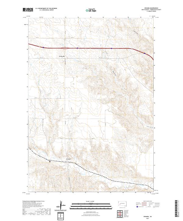
2021 Map of Owanka
USGS Topo · Published 2021About this map
Owanka and Wicksville are the primary settlements in this portion of Pennington County, situated within a landscape carved by significant drainage systems. The northern territory is dominated by the complex topography of Hawk Canyon and Madison Draw, while the southern reaches are defined by the winding course of Boxelder Cr. This map captures the modern rural infrastructure of the region, where Interstate 90 and HWY 1416 provide the principal east-west thoroughfares across the high plains.
Find a feature on this map
25 named features on this map. Tap any name to fly to it.
Don’t see what you’re looking for? This feature index may not catch every label — zoom into the map to look around manually.
Map Details
Editions of this 2021 Owanka Map
This is the sole edition of this map. No revisions or reprints were ever made.
Other maps of this area

1953 · Rapid City
USGS Topo · 1:250,000

1954 · Wasta
USGS Topo · 1:24,000

1954 · Owanka
USGS Topo · 1:24,000

1954 · Creston
USGS Topo · 1:24,000

1954 · Wasta NW
USGS Topo · 1:24,000

1954 · Brennan Flat
USGS Topo · 1:24,000

1954 · Quinn Table
USGS Topo · 1:24,000

1955 · Hot Springs
USGS Topo · 1:250,000

1957 · Rapid City
USGS Topo · 1:250,000
1957 · Owanka NE
USGS Topo · 1:24,000