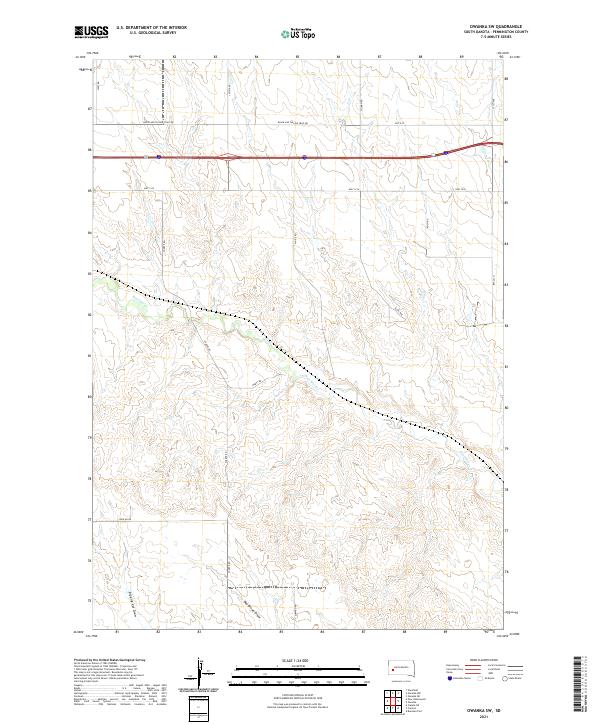
2021 Map of Owanka SW
USGS Topo · Published 2021About this map
Boxelder Cr meanders through the central and southern reaches of this Pennington County landscape, defining the drainage patterns of the western Great Plains. The map reveals a transition from the early automotive era to modern transit, preserved in the alignment of the Black and Yellow Trail Rd running parallel to the high-speed corridor of Interstate 90. This historic trail once served as a primary route for travelers heading toward the Black Hills, and its persistence alongside contemporary roads like Hwy 1416 provides a clear view of how regional transportation has evolved. Topographical details such as Day Brown Draw and Dipping Vat Draw highlight the seasonal watercourses and drainage basins that characterize this prairie environment. A grid of rural routes, including Sharpe Rd and Marty Rd, connects the scattered sections and suggests a landscape defined by ranching and agriculture.
Find a feature on this map
24 named features on this map. Tap any name to fly to it.
Don’t see what you’re looking for? This feature index may not catch every label — zoom into the map to look around manually.
Map Details
Editions of this 2021 Owanka SW Map
This is the sole edition of this map. No revisions or reprints were ever made.
Other maps of this area

1953 · Viewfield
USGS Topo · 1:24,000

1953 · New Underwood
USGS Topo · 1:24,000

1953 · Caputa NE
USGS Topo · 1:24,000

1953 · Rapid City
USGS Topo · 1:250,000

1954 · Owanka
USGS Topo · 1:24,000

1954 · Creston
USGS Topo · 1:24,000

1954 · Brennan Flat
USGS Topo · 1:24,000

1955 · Hot Springs
USGS Topo · 1:250,000

1957 · Rapid City
USGS Topo · 1:250,000
1957 · Owanka NE
USGS Topo · 1:24,000