
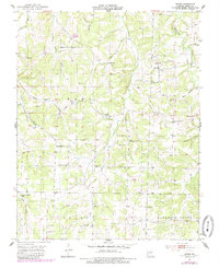
1951 Map of Owens
USGS Topo · Published 1952About this map
Gasconade River headwaters and a network of hollows define the Wright County landscape in this early 1950s survey. The rural community of Owens sits at the center of a settlement pattern dominated by family-named cemeteries and small country schoolhouses, reflecting the localized social structure of the Ozarks during this era. High ridges and deep karst features, including the Bruton Sinks, surround long hollows such as Long Hollow and Leonard Hollow.
Find a feature on this map
52 named features on this map. Tap any name to fly to it.
Don’t see what you’re looking for? This feature index may not catch every label — zoom into the map to look around manually.
Map Details
Editions of this 1951 Owens Map
2 editions found
Other maps of this area

1931 · Manes
USGS Topo · 1:48,000

1941 · Manes
USGS Topo · 1:62,500

1943 · Manes
USGS Topo · 1:62,500

1951 · Norwood
USGS Topo · 1:24,000

1951 · Mountain Grove South
USGS Topo · 1:24,000

1951 · Mountain Grove North
USGS Topo · 1:24,000

1951 · Mansfield NE
USGS Topo · 1:24,000
1951 · Mansfield
USGS Topo · 1:24,000

1951 · Mountain Grove
USGS Topo · 1:62,500

1954 · Springfield
USGS Topo · 1:250,000