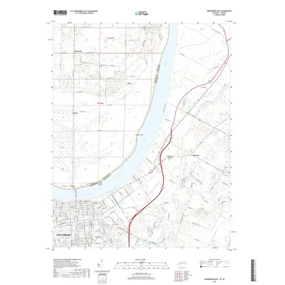
2019 Map of Owensboro East
USGS Topo · Published 2019About this map
The Ohio River carves a wide bend between Daviess County, Kentucky, and Spencer County, Indiana, defining the geography of this 2019 survey. On the southern bank, the eastern reaches of Owensboro show a densely platted street grid including W Parrish Ave and E 4th St, transitioning into a landscape heavily marked by historical burial grounds. Large tracts such as Rose-Hill Cem, Greenwood Cem, and the Rosewood - Elmwood Cem provide significant points of interest for genealogists tracing local families.
Find a feature on this map
134 named features on this map. Tap any name to fly to it.
Don’t see what you’re looking for? This feature index may not catch every label — zoom into the map to look around manually.
Map Details
Editions of this 2019 Owensboro East Map
This is the sole edition of this map. No revisions or reprints were ever made.
Other maps of this area

1901 · Owensboro
USGS Topo · 1:62,500

1903 · Tell City
USGS Topo · 1:62,500

1906 · Sutherland
USGS Topo · 1:62,500

1907 · Whitesville
USGS Topo · 1:62,500

1909 · Whitesville
USGS Topo · 1:62,500

1952 · Owensboro East
USGS Topo · 1:24,000

1952 · Rockport
USGS Topo · 1:24,000

1952 · Owensboro West
USGS Topo · 1:24,000

1953 · Philpot
USGS Topo · 1:24,000

1953 · Sutherland
USGS Topo · 1:24,000