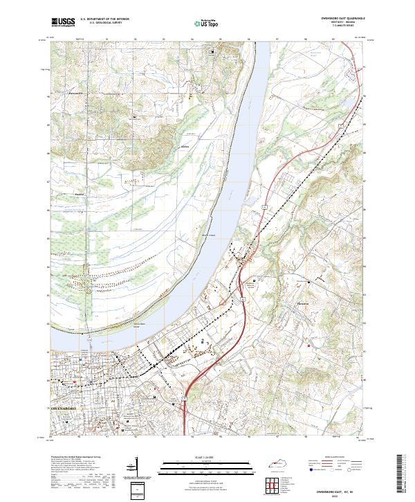
2022 Map of Owensboro East
USGS Topo · Published 2022About this map
The Ohio River forms a wide, sweeping bend between Kentucky and Indiana, anchoring this modern look at the borderlands of Daviess and Spencer counties. On the southern bank, the city of Owensboro dominates the landscape with its dense grid of streets, educational institutions like Brescia University, and civil landmarks such as the Holbrook Judicial Center. The city's northern edge is defined by significant memorial sites, including the extensive Rosehill - Elmwood Cem and Mausoleum North and Rosehill - Elmwood Cem and Mausoleum South.
Find a feature on this map
152 named features on this map. Tap any name to fly to it.
Don’t see what you’re looking for? This feature index may not catch every label — zoom into the map to look around manually.
Map Details
Editions of this 2022 Owensboro East Map
This is the sole edition of this map. No revisions or reprints were ever made.
Other maps of this area

1901 · Owensboro
USGS Topo · 1:62,500

1903 · Tell City
USGS Topo · 1:62,500

1906 · Sutherland
USGS Topo · 1:62,500

1907 · Whitesville
USGS Topo · 1:62,500

1909 · Whitesville
USGS Topo · 1:62,500

1952 · Owensboro East
USGS Topo · 1:24,000

1952 · Rockport
USGS Topo · 1:24,000

1952 · Owensboro West
USGS Topo · 1:24,000

1953 · Philpot
USGS Topo · 1:24,000

1953 · Sutherland
USGS Topo · 1:24,000