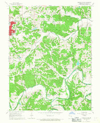
1966 Map of Owensville East
USGS Topo · Published 1967About this map
Owensville serves as the primary hub of this mid-1960s landscape, where the Chicago Rock Island and Pacific railroad bisects the town's grid. The surrounding Gasconade County countryside is defined by a dense network of extraction and agriculture, evidenced by numerous Claypits scattered across the terrain. These small industrial excavations dot the hillsides between the winding courses of the Bourbeuse River and Dry Fork, illustrating the area's geological and economic character during this era.
Find a feature on this map
30 named features on this map. Tap any name to fly to it.
Don’t see what you’re looking for? This feature index may not catch every label — zoom into the map to look around manually.
Map Details
Editions of this 1966 Owensville East Map
2 editions found
Other maps of this area

1903 · Sullivan
USGS Topo · 1:125,000

1934 · Bland
USGS Topo · 1:62,500

1934 · Redbird
USGS Topo · 1:62,500

1935 · Gerald
USGS Topo · 1:48,000

1937 · Bland
USGS Topo · 1:62,500

1938 · Redbird
USGS Topo · 1:62,500

1941 · Gerald
USGS Topo · 1:62,500

1944 · Gerald
USGS Topo · 1:62,500

1948 · Argo
USGS Topo · 1:24,000

1948 · Oak Hill
USGS Topo · 1:24,000