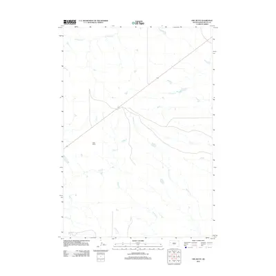
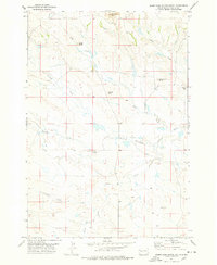
2012 Map of Owl Butte
USGS Topo · Published 2012About this map
Owl Butte rises as the central landmark of this Butte County landscape, marking a prominent point in a region defined by its complex drainage network. The terrain is deeply etched by numerous waterways that converge across the prairie, including Station Elm Cr and Mud Elm Cr, which feed into the primary course of Elm Cr. Further north, S Sulphur Cr and S Double R Cr carve through the northern reach, while Butte Cr and Eightmile Cr define the southern drainage patterns. This 2012 survey illustrates the path of U.S. Route 212, which serves as the primary corridor through this high plains environment. The map provides a detailed view of the natural topography and the essential transportation links that connect this part of South Dakota.
Find a feature on this map
9 named features on this map. Tap any name to fly to it.
Don’t see what you’re looking for? This feature index may not catch every label — zoom into the map to look around manually.
Map Details
Editions of this 2012 Owl Butte Map
This is the sole edition of this map. No revisions or reprints were ever made.
Other maps of this area

1906 · Vale
USGS Topo · 1:62,500

1913 · Newell
USGS Topo · 1:125,000

1951 · Vale NE
USGS Topo · 1:24,000

1951 · Vale
USGS Topo · 1:62,500

1953 · Rapid City
USGS Topo · 1:250,000

1957 · Rapid City
USGS Topo · 1:250,000
1959 · Volunteer NW
USGS Topo · 1:24,000
1959 · Volunteer NE
USGS Topo · 1:24,000
1973 · Owl Butte
USGS Topo · 1:24,000
1977 · Deers Ears Butte South
USGS Topo · 1:24,000