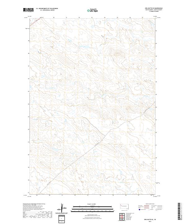
2021 Map of Owl Butte SE
USGS Topo · Published 2021About this map
The high plains of Butte County are defined by a sparse network of drainage and transportation, where S Sulphur Cr and Elm Cr carve subtle paths across the landscape. This part of South Dakota maintains its open agricultural character, marked by the diagonal transit of Highway 212 and the adjacent track of Old US Hwy 212. The presence of the old highway alignment provides a specific point of interest for those tracing the evolution of regional road networks and historical travel routes in the western part of the state. Aside from these features, the map remains largely dominated by the Public Land Survey System grid, which organizes the expansive ranching and grazing land into distinct sections and townships.
Find a feature on this map
10 named features on this map. Tap any name to fly to it.
Don’t see what you’re looking for? This feature index may not catch every label — zoom into the map to look around manually.
Map Details
Editions of this 2021 Owl Butte SE Map
This is the sole edition of this map. No revisions or reprints were ever made.
Other maps of this area

1913 · Newell
USGS Topo · 1:125,000

1953 · Rapid City
USGS Topo · 1:250,000

1957 · Rapid City
USGS Topo · 1:250,000
1959 · Volunteer NW
USGS Topo · 1:24,000
1959 · Volunteer NE
USGS Topo · 1:24,000

1959 · Fairpoint NW
USGS Topo · 1:24,000
1973 · Owl Butte
USGS Topo · 1:24,000
1977 · Deers Ears Butte South
USGS Topo · 1:24,000

1977 · Table Top Butte
USGS Topo · 1:24,000
1977 · Owl Butte SE
USGS Topo · 1:24,000