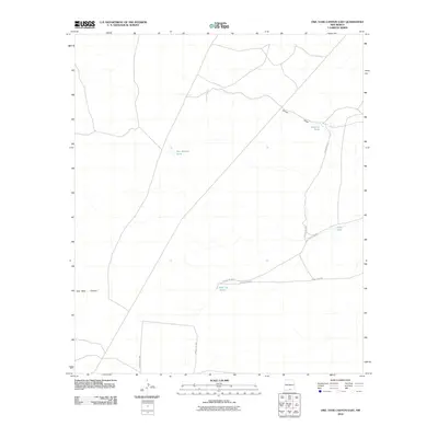
2010 Map of Owl Tank Canyon East
USGS Topo · Published 2010About this map
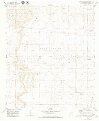
Shiloh Draw winds through this arid Otero County landscape, defining the primary drainage pattern for an area characterized by scattered water catchment features. During this 2010 survey period, the reliance on these isolated water sources is evident in labels such as Roberts Tank, Johno Tank, and the Wet Weather Pond. These features, alongside the Red Top Tanks, suggest a landscape managed for livestock or wildlife in a region where permanent surface water is scarce. The southern portion of the map is marked by the eponymous Owl Tank Canyon. A sparse network of unpaved routes, including County Rd F057 and County Rd F058, provides the only infrastructure through this open terrain, connecting the various tanks and draws across the high desert.
Find a feature on this map
9 named features on this map. Tap any name to fly to it.
Don’t see what you’re looking for? This feature index may not catch every label — zoom into the map to look around manually.
Map Details
Editions of this 2010 Owl Tank Canyon East Map
This is the sole edition of this map. No revisions or reprints were ever made.
Other maps of this area

1940 · Bassett Lake
USGS Topo · 1:62,500

1943 · Pendejo Wash
USGS Topo · 1:62,500

1943 · Bassett Lake
USGS Topo · 1:62,500

1954 · Carlsbad
USGS Topo · 1:250,000

1958 · Carlsbad
USGS Topo · 1:250,000

1959 · Alamo Mountain
USGS Topo · 1:62,500
1975 · Alamo Mountain
USGS Topo · 1:24,000
1975 · B T Ranch
USGS Topo · 1:24,000
1979 · Mack Tanks
USGS Topo · 1:24,000
1979 · Otero Mesa South
USGS Topo · 1:24,000