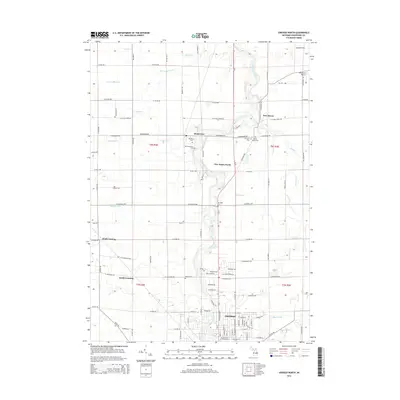
2014 Map of Owosso North
USGS Topo · Published 2014About this map
The Shiawassee River winds through the heart of this Shiawassee County landscape, serving as the central topographical spine for the surrounding agricultural and residential developments. To the south, the city of Owosso extends its residential grid toward the river, while smaller unincorporated settlements like Henderson and New Haven punctuate the northern sections of the map. The area is dense with sites of interest for genealogists, featuring several pairs of burial grounds such as Henderson Cem and the nearby Old Henderson Cem, as well as W Haven Cem and its historic counterpart, Old W Haven Cem. The land is heavily drained by a complex network of named channels, including Edgar Drain and Osburn Drain, which reflect the region's managed water systems. Modern aviation is represented by Wightman Airport in the northeast, while the Chippewa Trl follows the riverbank, hinting at much older transit corridors through this Michigan terrain.
Find a feature on this map
105 named features on this map. Tap any name to fly to it.
Don’t see what you’re looking for? This feature index may not catch every label — zoom into the map to look around manually.
Map Details
Editions of this 2014 Owosso North Map
This is the sole edition of this map. No revisions or reprints were ever made.
Other maps of this area

1917 · Chesaning
USGS Topo · 1:62,500

1918 · Elsie
USGS Topo · 1:62,500

1926 · Corunna
USGS Topo · 1:62,500

1928 · Laingsburg
USGS Topo · 1:62,500

1929 · Corunna
USGS Topo · 1:62,500

1943 · Chesaning
USGS Topo · 1:62,500

1943 · Elsie
USGS Topo · 1:62,500

1944 · Laingsburg
USGS Topo · 1:62,500

1944 · Corunna
USGS Topo · 1:62,500

1954 · Midland
USGS Topo · 1:250,000