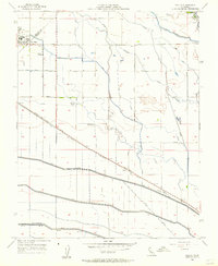
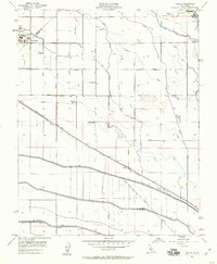
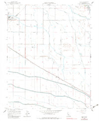
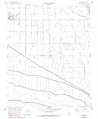
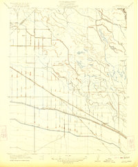
1956 Map of Oxalis
USGS Topo · Published 1957About this map
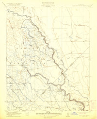
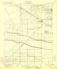
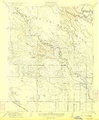
The border between Merced and Fresno counties bisects this 1950s landscape, defined by a complex network of irrigation and transportation infrastructure. Centered on the community of Dos Palos, the area is heavily marked by water management systems including the massive Delta-Mendota Canal and numerous smaller channels like the Poso Canal, Santa Fe Canal, and Outside Canal. These waterways supported established agricultural operations such as Wolfson Ranch, Holland Farm, and Hog Ranch. Education is anchored by the Joint Union H S and Bryant School, while the southern reaches show the industrial footprint of the Silaxo Oil Pumping Sta. The movement of goods and people relied on the Southern Pacific railroad line, which passes through the small stop of Oxalis, alongside an extensive grid of local avenues that weave through the Central Valley basin.
Find a feature on this map
44 named features on this map. Tap any name to fly to it.
Don’t see what you’re looking for? This feature index may not catch every label — zoom into the map to look around manually.
Map Details
Editions of this 1956 Oxalis Map
4 editions found
Other maps of this area

1913 · Panoche
USGS Topo · 1:125,000

1916 · Santa Rita Bridge
USGS Topo · 1:24,000

1916 · Delta Ranch
USGS Topo · 1:24,000

1918 · Bliss Ranch
USGS Topo · 1:31,680

1920 · Santa Rita Bridge
USGS Topo · 1:31,680
1922 · Oxalis
USGS Topo · 1:31,680
1922 · Santa Rita Bridge
USGS Topo · 1:31,680
1922 · Dos Palos
USGS Topo · 1:31,680

1922 · Pozo Farm
USGS Topo · 1:31,680
1922 · Delta Ranch
USGS Topo · 1:31,680