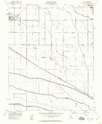
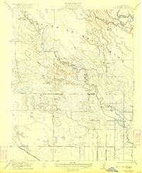
1956 Map of Oxalis
USGS Topo · Published 1960About this map
Dos Palos and the surrounding agricultural lands of the San Joaquin Valley define this mid-century survey, revealing a landscape deeply engineered for water and transport. The Southern Pacific railroad runs diagonally across the terrain, serving the small station of Oxalis and providing a vital link for local commerce. Educational hubs like Bryant School and the Joint Union H S serve the scattered ranching communities, while large operations such as Wolfson Ranch, Holland Farm, and Hog Ranch highlight the scale of early postwar farming in the region.
Find a feature on this map
30 named features on this map. Tap any name to fly to it.
Don’t see what you’re looking for? This feature index may not catch every label — zoom into the map to look around manually.
Map Details
Editions of this 1956 Oxalis Map
4 editions found
Other maps of this area

1913 · Panoche
USGS Topo · 1:125,000

1916 · Santa Rita Bridge
USGS Topo · 1:24,000

1916 · Delta Ranch
USGS Topo · 1:24,000

1918 · Bliss Ranch
USGS Topo · 1:31,680

1920 · Santa Rita Bridge
USGS Topo · 1:31,680

1922 · Oxalis
USGS Topo · 1:31,680

1922 · Santa Rita Bridge
USGS Topo · 1:31,680

1922 · Dos Palos
USGS Topo · 1:31,680

1922 · Pozo Farm
USGS Topo · 1:31,680
1922 · Delta Ranch
USGS Topo · 1:31,680