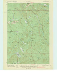
1942 Map of Oxbow
USGS Topo · Published 1942About this map
Oxbow and Masardis serve as the primary anchors of settlement in this northern Maine landscape, surveyed just before the United States entered the second World War. The area is defined by the winding course of the Aroostook River and a dense network of timber-harvesting infrastructure. Notable for local historians are the Willard Cem and Oxbow Cem, along with the East End Sch.
Find a feature on this map
68 named features on this map. Tap any name to fly to it.
Don’t see what you’re looking for? This feature index may not catch every label — zoom into the map to look around manually.
Map Details
Editions of this 1942 Oxbow Map
2 editions found

Other maps of this area

1930 · Greenlaw
USGS Topo · 1:48,000

1931 · Ashland
USGS Topo · 1:48,000

1933 · Greenlaw
USGS Topo · 1:62,500

1934 · Ashland
USGS Topo · 1:62,500

1935 · Howe Brook
USGS Topo · 1:48,000

1935 · Presque Isle
USGS Topo · 1:62,500

1937 · Smyrna Mills
USGS Topo · 1:62,500

1939 · Howe Brook
USGS Topo · 1:62,500

1940 · Island Falls
USGS Topo · 1:62,500

1940 · Oxbow
USGS Topo · 1:62,500