
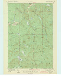
1942 Map of Oxbow
USGS Topo · Published 1942About this map
The Aroostook River and the Bangor and Aroostook railroad corridor define the settlement patterns of this North Woods territory just before mid-century. While the village of Oxbow serves as a local hub with its East End Sch and twin cemeteries, Willard Cem and Oxbow Cem, the surrounding township is characterized by remote outposts and seasonal camps. Loggers and sportsmen utilize sites like Camp Violette, Camp Dana, and McManus Camp, many of which are accessible only via a network of rough tracks including Loghauler Road and various tote roads.
Find a feature on this map
72 named features on this map. Tap any name to fly to it.
Don’t see what you’re looking for? This feature index may not catch every label — zoom into the map to look around manually.
Map Details
Editions of this 1942 Oxbow Map
2 editions found
Other maps of this area

1930 · Greenlaw
USGS Topo · 1:48,000

1931 · Ashland
USGS Topo · 1:48,000

1933 · Greenlaw
USGS Topo · 1:62,500

1934 · Ashland
USGS Topo · 1:62,500

1935 · Howe Brook
USGS Topo · 1:48,000

1935 · Presque Isle
USGS Topo · 1:62,500

1937 · Smyrna Mills
USGS Topo · 1:62,500

1939 · Howe Brook
USGS Topo · 1:62,500

1940 · Island Falls
USGS Topo · 1:62,500

1940 · Oxbow
USGS Topo · 1:62,500