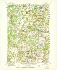
1961 Map of Oxford
USGS Topo · Published 1972About this map
Oxford sits at the crossing of the Chicago and North Western railway and Neenah Creek, serving as a central hub for this portion of Marquette County. The landscape is defined by its glacial heritage, dotted with numerous kettle lakes and marshes such as Lawrence Lake, Parker Lake, and the winding Lawrence Creek. To the west, the terrain rises into prominent landforms like Spring Bluff and Pilot Knob Bluff, while the southern reaches contain a U S Military Reservation.
Find a feature on this map
68 named features on this map. Tap any name to fly to it.
Don’t see what you’re looking for? This feature index may not catch every label — zoom into the map to look around manually.
Map Details
Editions of this 1961 Oxford Map
2 editions found

Other maps of this area

1901 · The Dells
USGS Topo · 1:62,500

1902 · Portage
USGS Topo · 1:62,500

1902 · Briggsville
USGS Topo · 1:62,500

1955 · Green Bay
USGS Topo · 1:250,000

1957 · Wisconsin Dells
USGS Topo · 1:62,500

1957 · Madison
USGS Topo · 1:250,000

1958 · Briggsville
USGS Topo · 1:62,500

1958 · Arkdale
USGS Topo · 1:48,000

1958 · Coloma
USGS Topo · 1:48,000

1959 · Wautoma
USGS Topo · 1:48,000