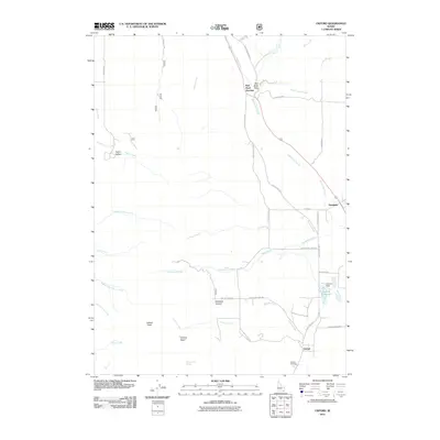
2011 Map of Oxford
USGS Topo · Published 2011About this map
Oxford is positioned at the base of the mountains in Franklin County, where the valley floor meets the high peaks of the Portneuf Range. This 2011 survey documents a landscape defined by significant water management and elevation changes, from the heights of Oxford Peak and Oxford Basin down to the Oxford Reservoir. The settlement pattern follows the north-south corridors of the N Westside Hwy and Old Oxford Hwy S, connecting local landmarks like the Oxford Cemetery to the smaller community of Swanlake further north.
Find a feature on this map
44 named features on this map. Tap any name to fly to it.
Don’t see what you’re looking for? This feature index may not catch every label — zoom into the map to look around manually.
Map Details
Editions of this 2011 Oxford Map
This is the sole edition of this map. No revisions or reprints were ever made.
Other maps of this area

1915 · Preston
USGS Topo · 1:96,000

1918 · Preston
USGS Topo · 1:125,000

1954 · Pocatello
USGS Topo · 1:250,000

1955 · Preston
USGS Topo · 1:250,000

1958 · Pocatello
USGS Topo · 1:250,000

1958 · Preston
USGS Topo · 1:250,000

1962 · Preston
USGS Topo · 1:250,000

1968 · Malad Summit
USGS Topo · 1:24,000

1968 · Oxford
USGS Topo · 1:24,000

1968 · Downey West
USGS Topo · 1:24,000