2024 Map of Oxford
USGS Topo · Published 2024About this map
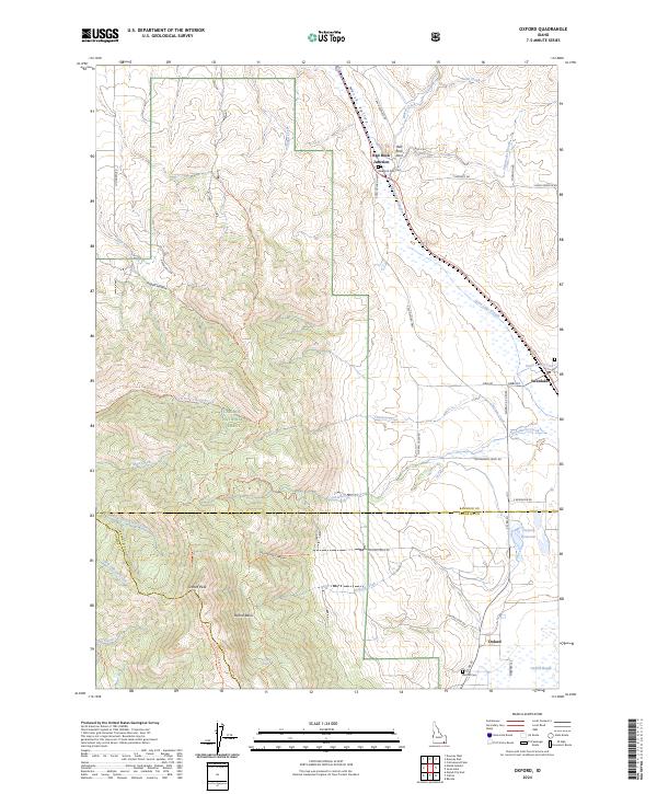
Oxford sits at the base of the mountains in this southeastern Idaho corridor, where the agricultural flats meet the rising slopes of the Caribou National Forest. The landscape is defined by its water management and distinct natural landmarks, notably the Oxford Reservoir and the expansive Oxford Slough Waterfowl Production Area. To the north, Red Rock Pass serves as a critical geographic notch in the Marsh Valley, home to Red Rock Junction and the nearby Red Rock Pass Cem. This area reveals the transition from high-elevation peaks like Oxford Peak and the Oxford Ridge Trl down into the valley floor. Small settlements like Swanlake are connected by a network of rural routes such as S Old Oxford Hwy and Gibbs Rd, tracing the edges of Swan Lake Slough and the various creeks that descend from the western canyons.
Find a feature on this map
49 named features on this map. Tap any name to fly to it.
Don’t see what you’re looking for? This feature index may not catch every label — zoom into the map to look around manually.
Map Details
Editions of this 2024 Oxford Map
This is the sole edition of this map. No revisions or reprints were ever made.