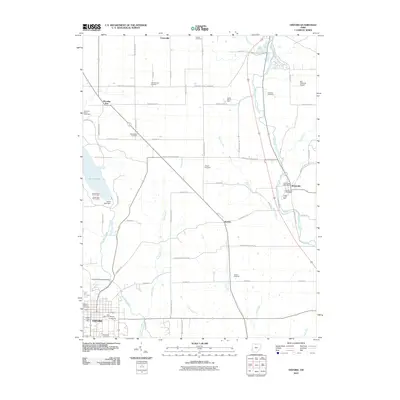
2010 Map of Oxford
USGS Topo · Published 2010About this map
Miami University serves as a major anchor in the southwestern corner of this Butler County landscape, where the academic grounds of Oxford meet the rural reaches of Oxford Township. The terrain is defined by the winding course of Four Mile Creek and Sevenmile Creek, which carve through the countryside toward the settlements of Somerville and Jericho. In the west, Hueston Woods State Park surrounds Acton Lake, a notable local landmark controlled by the Acton Lake Dam. Local history and genealogy are well-represented by numerous family burial grounds, including the John Ramsey Cemetery and Teague Cemetery, while the Pughs Mill Covered Bridge stands as a distinct structural remnant of the area's transit history. The rural grid is further punctuated by agrarian landmarks like Owens Orchards and the Joe Cimprich Airport.
Find a feature on this map
63 named features on this map. Tap any name to fly to it.
Don’t see what you’re looking for? This feature index may not catch every label — zoom into the map to look around manually.
Map Details
Editions of this 2010 Oxford Map
This is the sole edition of this map. No revisions or reprints were ever made.
Other maps of this area

1911 · Oxford
USGS Topo · 1:62,500

1915 · College Corner
USGS Topo · 1:48,000

1915 · Harrison
USGS Topo · 1:48,000

1915 · Hamilton
USGS Topo · 1:62,500

1917 · Hamilton
USGS Topo · 1:62,500

1918 · College Corner
USGS Topo · 1:62,500

1953 · Cincinnati
USGS Topo · 1:250,000

1955 · Hamilton
USGS Topo · 1:24,000

1955 · Reily
USGS Topo · 1:24,000
1955 · Millville
USGS Topo · 1:24,000