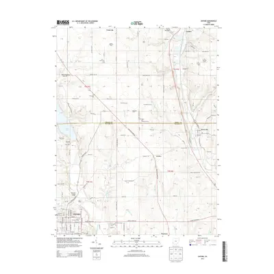
2013 Map of Oxford
USGS Topo · Published 2013About this map
Miami University-Oxford anchors the southern portion of this region, where the campus layout meets the grid of Oxford. The landscape transitions from the academic and residential core of the city into a patchwork of named agricultural holdings such as Stoney Hedgerow Farm, Cimprich Farms, and Dream Acres Farm. To the northwest, the waters of Acton Lake are framed by the protected lands of Hueston Woods State Park, a significant recreational area featuring the Locust Grove Picnic Area.
Find a feature on this map
105 named features on this map. Tap any name to fly to it.
Don’t see what you’re looking for? This feature index may not catch every label — zoom into the map to look around manually.
Map Details
Editions of this 2013 Oxford Map
This is the sole edition of this map. No revisions or reprints were ever made.
Other maps of this area

1911 · Oxford
USGS Topo · 1:62,500

1915 · College Corner
USGS Topo · 1:48,000

1915 · Harrison
USGS Topo · 1:48,000

1915 · Hamilton
USGS Topo · 1:62,500

1917 · Hamilton
USGS Topo · 1:62,500

1918 · College Corner
USGS Topo · 1:62,500

1953 · Cincinnati
USGS Topo · 1:250,000

1955 · Hamilton
USGS Topo · 1:24,000

1955 · Reily
USGS Topo · 1:24,000
1955 · Millville
USGS Topo · 1:24,000