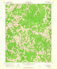
1964 Map of Oxford
USGS Topo · Published 1966About this map
The Hughes River and the South Fork Hughes River carve through the landscape of Doddridge and Ritchie counties, anchoring a network of small agricultural and resource-based communities. Small settlements like Oxford, Porto Rico, and Holbrook are connected by winding valley roads that follow the paths of numerous runs and forks, such as Cain Run and Otterslide Creek. The presence of several pumping stations and a vast network of gas wells indicates the region's historical reliance on the natural gas industry during the mid-1960s.
Find a feature on this map
57 named features on this map. Tap any name to fly to it.
Don’t see what you’re looking for? This feature index may not catch every label — zoom into the map to look around manually.
Map Details
Editions of this 1964 Oxford Map
3 editions found
Other maps of this area

1904 · Vadis
USGS Topo · 1:62,500

1905 · Centerpoint
USGS Topo · 1:62,500

1905 · West Union
USGS Topo · 1:62,500

1906 · Holbrook
USGS Topo · 1:62,500

1924 · Centerpoint
USGS Topo · 1:62,500

1924 · West Union
USGS Topo · 1:62,500

1924 · Holbrook
USGS Topo · 1:62,500

1925 · Centerpoint
USGS Topo · 1:62,500

1925 · Vadis
USGS Topo · 1:62,500

1926 · Holbrook
USGS Topo · 1:62,500