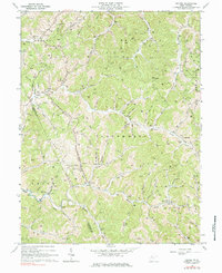
1964 Map of Oxford
USGS Topo · Published 1984About this map
Oxford sits at the junction of Clevenger Fork and Taylor Drain in this mid-century portrait of rural Doddridge County. The landscape is defined by the winding course of the Middle Fork Hughes River and the South Fork Hughes River, where family names are etched into the terrain through numerous burial grounds like Maxwell Cem, Nutter Cem, and Michaels Cem. This area was a center of early 20th-century energy extraction, evidenced by the dense concentration of Gas Wells and Oil Wells scattered across the ridges of West Union and Central districts.
Find a feature on this map
73 named features on this map. Tap any name to fly to it.
Don’t see what you’re looking for? This feature index may not catch every label — zoom into the map to look around manually.
Map Details
Editions of this 1964 Oxford Map
3 editions found
Other maps of this area

1904 · Vadis
USGS Topo · 1:62,500

1905 · Centerpoint
USGS Topo · 1:62,500

1905 · West Union
USGS Topo · 1:62,500

1906 · Holbrook
USGS Topo · 1:62,500

1924 · Centerpoint
USGS Topo · 1:62,500

1924 · West Union
USGS Topo · 1:62,500

1924 · Holbrook
USGS Topo · 1:62,500

1925 · Centerpoint
USGS Topo · 1:62,500

1925 · Vadis
USGS Topo · 1:62,500

1926 · Holbrook
USGS Topo · 1:62,500