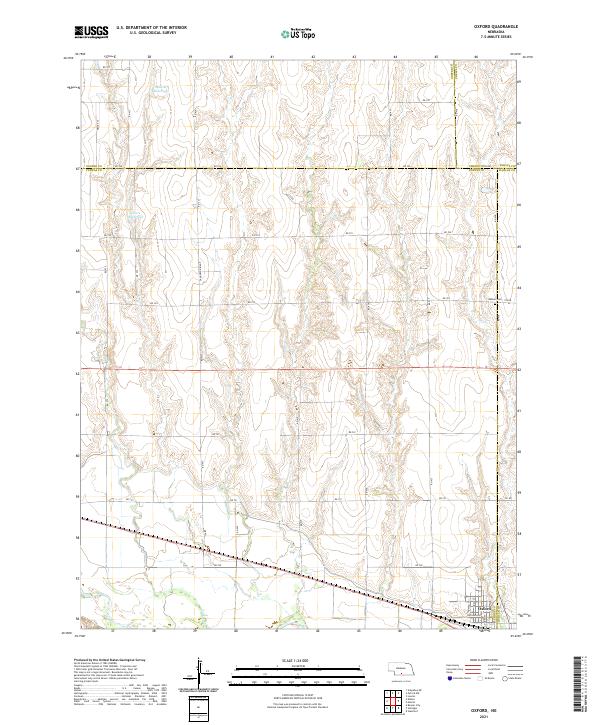
2021 Map of Oxford
USGS Topo · Published 2021About this map
Oxford occupies the southeastern corner of this landscape, situated near the confluence of local drainages and the Republican River valley just beyond the map's edge. The surrounding terrain is defined by the high ground of Sanderson Ridge, which overlooks a dissected prairie landscape shaped by Turkey Cr. Agricultural water management is evident through the presence of the Maaske Reservoir and Grove Reservoir in the northern sections, highlighting the modification of the Nebraska plains for late 20th and early 21st-century land use. For genealogists, the Kellner Cem on the eastern boundary provides a specific point of interest, while the grid of rural roads, including Rd 726 and Drive 432, reflects the enduring section-line settlement pattern of the region.
Find a feature on this map
41 named features on this map. Tap any name to fly to it.
Don’t see what you’re looking for? This feature index may not catch every label — zoom into the map to look around manually.
Map Details
Editions of this 2021 Oxford Map
This is the sole edition of this map. No revisions or reprints were ever made.
Other maps of this area

1896 · Arapahoe
USGS Topo · 1:125,000

1898 · Arapahoe
USGS Topo · 1:125,000

1955 · Grand Island
USGS Topo · 1:250,000

1957 · Grand Island
USGS Topo · 1:250,000

1958 · Grand Island
USGS Topo · 1:250,000

1958 · Edison
USGS Topo · 1:24,000

1958 · Hollinger
USGS Topo · 1:24,000
1958 · Beaver City
USGS Topo · 1:24,000

1958 · Stamford
USGS Topo · 1:24,000

1958 · Mascot
USGS Topo · 1:24,000