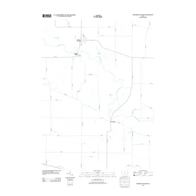
2013 Map of Oxford Junction
USGS Topo · Published 2013About this map
The Wapsipinicon River carves a winding path through Jones County, anchoring the small communities of Oxford Junction, Oxford Mills, and Massillon. This landscape is defined by its riparian geometry, where numerous tributaries like Mill Cr, Plum Cr, and Bryan Cr feed into the main river channel. The area around Oxford Junction shows a concentrated street grid including Main St and B St, while the surrounding countryside is dotted with oxbow lakes and wetlands such as Bullhead Lake, East Goose Lake, and West Goose Lake. These water features suggest a complex floodplain history that has shaped local development and agriculture. Further south, Yankee Run flows through the lower portion of the quadrangle, illustrating the dense network of small waterways that once drove the local milling economy and still dictate the placement of county roads like Co RD-e45 and Co RD-x64.
Find a feature on this map
60 named features on this map. Tap any name to fly to it.
Don’t see what you’re looking for? This feature index may not catch every label — zoom into the map to look around manually.
Map Details
Editions of this 2013 Oxford Junction Map
This is the sole edition of this map. No revisions or reprints were ever made.
Other maps of this area

1889 · Tipton
USGS Topo · 1:62,500

1890 · Tipton
USGS Topo · 1:62,500

1891 · Monticello
USGS Topo · 1:62,500

1891 · Baldwin
USGS Topo · 1:62,500

1892 · Wheatland
USGS Topo · 1:62,500

1894 · Wheatland
USGS Topo · 1:62,500

1900 · Anamosa
USGS Topo · 1:125,000

1901 · Peosta
USGS Topo · 1:125,000

1901 · Rock Island
USGS Topo · 1:125,000

1901 · Stanwood
USGS Topo · 1:125,000