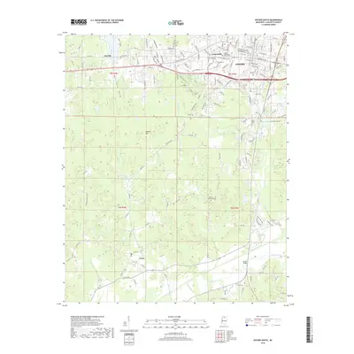
2018 Map of Oxford South
USGS Topo · Published 2018About this map
The Univ of Mississippi Main Campus and the southern reaches of Oxford define the northern portion of this landscape, where the academic grounds transition into the residential and commercial developments of Lafayette County. Further south, the rural character of the region is preserved along the Yocona River and its tributaries, including Toby Tubby Cr and Murray Creek. This 2018 survey reveals the settlement patterns of the area, from the established town of Taylor in the southwest to the community of Alesville in the northwest.
Find a feature on this map
146 named features on this map. Tap any name to fly to it.
Don’t see what you’re looking for? This feature index may not catch every label — zoom into the map to look around manually.
Map Details
Editions of this 2018 Oxford South Map
This is the sole edition of this map. No revisions or reprints were ever made.
Other maps of this area

1940 · Oxford
USGS Topo · 1:62,500

1942 · Denmark
USGS Topo · 1:62,500

1943 · Denmark
USGS Topo · 1:62,500

1943 · Oxford
USGS Topo · 1:62,500

1954 · Water Valley
USGS Topo · 1:62,500

1954 · Water Valley West
USGS Topo · 1:24,000

1955 · Water Valley
USGS Topo · 1:62,500

1956 · Tupelo
USGS Topo · 1:250,000

1958 · Tupelo
USGS Topo · 1:250,000

1972 · Paris
USGS Topo · 1:24,000