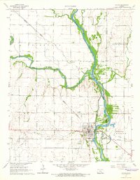
1965 Map of Oxford
USGS Topo · Published 1966About this map
The confluence of the Ninnescah River and the Arkansas River serves as the focal point for this mid-1960s survey of southern Kansas. The town of Oxford sits at this strategic junction, showing a developed street grid supported by the Atchison Topeka and Santa Fe railroad line. Local industry and energy extraction are evident through the Slick-Carson Oil Field in the southeast and various oil wells and sandpits scattered near the riverbanks.
Find a feature on this map
28 named features on this map. Tap any name to fly to it.
Don’t see what you’re looking for? This feature index may not catch every label — zoom into the map to look around manually.
Map Details
Editions of this 1965 Oxford Map
2 editions found
Other maps of this area

1890 · Wellington
USGS Topo · 1:125,000

1955 · Udall
USGS Topo · 1:24,000

1955 · Belle Plaine
USGS Topo · 1:24,000

1955 · Mulvane
USGS Topo · 1:24,000

1955 · Wichita
USGS Topo · 1:250,000

1958 · Wichita
USGS Topo · 1:250,000

1964 · South Haven NE
USGS Topo · 1:24,000

1964 · Dalton
USGS Topo · 1:24,000

1965 · Adamsville
USGS Topo · 1:24,000
1965 · Hackney
USGS Topo · 1:24,000