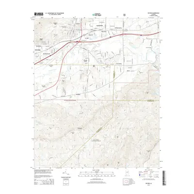
2014 Map of Oxford
USGS Topo · Published 2014About this map
Oxford and Anniston anchor the northern landscape of this region, where suburban expansion meets the southern foothills of the Appalachians. The transition from industrial and residential centers to the sprawling wilderness of the Talladega National Forest is clear, with the forest occupying much of the southern half of the quadrangle. Significant water features like Choccolocco Creek and Oxford Lake drain the basin between ridges such as Oak Mtn and Horseblock Mtn.
Find a feature on this map
99 named features on this map. Tap any name to fly to it.
Don’t see what you’re looking for? This feature index may not catch every label — zoom into the map to look around manually.
Map Details
Editions of this 2014 Oxford Map
This is the sole edition of this map. No revisions or reprints were ever made.
Other maps of this area

1891 · Ashland
USGS Topo · 1:125,000

1900 · Anniston
USGS Topo · 1:125,000

1947 · Oxford
USGS Topo · 1:24,000

1947 · Anniston
USGS Topo · 1:24,000

1947 · Eulaton
USGS Topo · 1:24,000

1947 · Munford
USGS Topo · 1:24,000

1950 · Anniston
USGS Topo · 1:62,500

1953 · Atlanta
USGS Topo · 1:250,000

1954 · Choccolocco
USGS Topo · 1:24,000

1956 · Munford
USGS Topo · 1:24,000