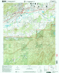
2001 Map of Oxford
USGS Topo · Published 2004About this map
Oxford and Anniston anchor the northern reaches of this landscape, where the urban corporate boundaries meet the dense woodlands of the Talladega National Forest. This 2001 revision highlights the juxtaposition between the growing infrastructure surrounding the Anniston-Calhoun Co Airport and the persistent rural character of the southern hills. Notable for genealogists, the map preserves the locations of numerous community anchors, including the County Training Sch in Hobson City and scattered country congregations like Antioch Ch and Bethlehem Ch.
Find a feature on this map
46 named features on this map. Tap any name to fly to it.
Don’t see what you’re looking for? This feature index may not catch every label — zoom into the map to look around manually.
Map Details
Editions of this 2001 Oxford Map
This is the sole edition of this map. No revisions or reprints were ever made.
Other maps of this area

1891 · Ashland
USGS Topo · 1:125,000

1900 · Anniston
USGS Topo · 1:125,000

1947 · Oxford
USGS Topo · 1:24,000

1947 · Anniston
USGS Topo · 1:24,000

1947 · Eulaton
USGS Topo · 1:24,000

1947 · Munford
USGS Topo · 1:24,000

1950 · Anniston
USGS Topo · 1:62,500

1953 · Atlanta
USGS Topo · 1:250,000

1954 · Choccolocco
USGS Topo · 1:24,000

1956 · Munford
USGS Topo · 1:24,000