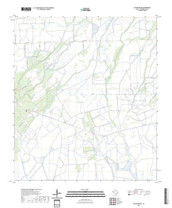
2025 Map of Oyster Bayou
USGS Topo · Published 2025About this map
Jackson Cem sits as a quiet landmark within a landscape defined by the intricate hydrology of the Texas Gulf Coast. This area is characterized by the convergence of several major watercourses, including the East Fork Double Bayou and Chimney Bayou, which snake through low-lying terrain. The map illustrates a contemporary rural infrastructure where long-established routes like Smith Point Rd and Fairview Rd provide access through the wetlands and fields of Chambers County.
Find a feature on this map
9 named features on this map. Tap any name to fly to it.
Don’t see what you’re looking for? This feature index may not catch every label — zoom into the map to look around manually.
Map Details
Editions of this 2025 Oyster Bayou Map
This is the sole edition of this map. No revisions or reprints were ever made.
Other maps of this area

1931 · High Island
USGS Topo · 1:24,000

1931 · Frozen Point
USGS Topo · 1:24,000

1933 · Frozen Point
USGS Topo · 1:31,680

1933 · Whites Lake
USGS Topo · 1:31,680

1942 · Anahuac
USGS Topo · 1:24,000

1943 · High Island
USGS Topo · 1:31,680

1943 · Frozen Point
USGS Topo · 1:24,000
1943 · Lake Stephenson
USGS Topo · 1:24,000

1943 · Sea Breeze
USGS Topo · 1:24,000

1943 · Stowell
USGS Topo · 1:24,000