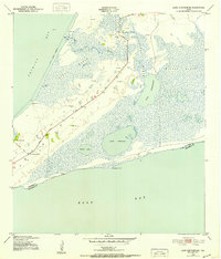
1943 Map of Lake Stephenson
USGS Topo · Published 1952About this map
The coastal wetlands of Chambers County are meticulously documented in this mid-century survey, conducted by the Army Map Service and U.S. Geological Survey during the Second World War. The landscape is dominated by the vast Gordy Marsh and Willow Marsh, areas where land and water intersect through a network of bayous and lakes. Local community life centers on the southwestern peninsula, where Smith Point Road terminates near the Smith Point School and the Frankland Cemetery.
Find a feature on this map
19 named features on this map. Tap any name to fly to it.
Don’t see what you’re looking for? This feature index may not catch every label — zoom into the map to look around manually.
Map Details
Editions of this 1943 Lake Stephenson Map
This is the sole edition of this map. No revisions or reprints were ever made.
Other maps of this area

1931 · Flake
USGS Topo · 1:24,000

1931 · Frozen Point
USGS Topo · 1:24,000

1932 · Bolivar Point
USGS Topo · 1:24,000

1933 · Frozen Point
USGS Topo · 1:31,680

1933 · Caplen
USGS Topo · 1:31,680

1933 · Whites Lake
USGS Topo · 1:31,680

1933 · Smith Point
USGS Topo · 1:31,680

1933 · Bolivar Point
USGS Topo · 1:31,680

1933 · Flake
USGS Topo · 1:31,680

1943 · West of Eagle
USGS Topo · 1:31,680