
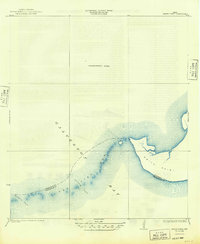
1933 Map of Smith Point
USGS Topo · Published 1933About this map
Smith Point extends into the waters where the Chambers Co and Galveston Co line bisects the coastal landscape. This 1933 edition, based on 1932 shoreline data, documents the intricate marine geography of the eastern reach of Galveston Bay. A series of natural channels and shoals, including Fish Bar and the navigable openings of Possum Pass, Red Pass, and Middle Pass, define the aquatic border between the counties.
Find a feature on this map
9 named features on this map. Tap any name to fly to it.
Don’t see what you’re looking for? This feature index may not catch every label — zoom into the map to look around manually.
Map Details
Editions of this 1933 Smith Point Map
2 editions found
Other maps of this area

1916 · Morgan Point
USGS Topo · 1:24,000

1919 · Morgan Point
USGS Topo · 1:31,680

1929 · Texas City
USGS Topo · 1:24,000

1931 · Flake
USGS Topo · 1:24,000

1932 · Clifton By The Sea
USGS Topo · 1:31,680

1932 · Texas City
USGS Topo · 1:31,680

1932 · Bolivar Point
USGS Topo · 1:24,000

1933 · Whites Lake
USGS Topo · 1:31,680

1933 · Bolivar Point
USGS Topo · 1:31,680

1933 · Flake
USGS Topo · 1:31,680