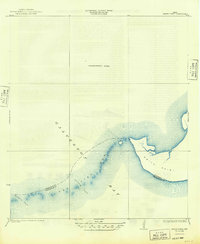
1933 Map of Smith Point
USGS Topo · Published 1949About this map
Smith Point stands as a prominent coastal projection in the northeastern waters of Galveston Bay, marking a significant nautical and geographical boundary in the early 1930s. This survey, based on shorelines compiled in 1932, illustrates the intricate bathymetry and shifting shoals that defined the maritime landscape before modern coastal engineering significantly altered the region. The map meticulously traces the underwater topography of Red Fish Bar, a critical natural feature that historically segmented the bay.
Find a feature on this map
8 named features on this map. Tap any name to fly to it.
Don’t see what you’re looking for? This feature index may not catch every label — zoom into the map to look around manually.
Map Details
Editions of this 1933 Smith Point Map
2 editions found
Other maps of this area

1916 · Morgan Point
USGS Topo · 1:24,000

1919 · Morgan Point
USGS Topo · 1:31,680

1929 · Texas City
USGS Topo · 1:24,000

1931 · Flake
USGS Topo · 1:24,000

1932 · Clifton By The Sea
USGS Topo · 1:31,680

1932 · Texas City
USGS Topo · 1:31,680

1932 · Bolivar Point
USGS Topo · 1:24,000

1933 · Whites Lake
USGS Topo · 1:31,680

1933 · Smith Point
USGS Topo · 1:31,680

1933 · Bolivar Point
USGS Topo · 1:31,680