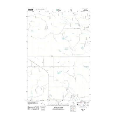
2011 Map of Ozark
USGS Topo · Published 2011About this map
Ozark and the surrounding Mackinac County wetlands are defined by a network of creeks and marshes, including the expansive Schlehubers Marsh and the winding North Branch Carp River. The landscape is largely dedicated to forestry and outdoor recreation, evidenced by the presence of the Trout Lake Lookout Tower and multiple forest service sites like Dick Campground. For genealogists and local historians, the Brethren Cemetery situated along 27 Mile Rd serves as a critical local landmark for tracing family roots in this corner of the Upper Peninsula. The drainage patterns of Pine River and Lumpson Creek dictate the local geography, with small bodies of water such as Bobbygay Lake and Koski Pond dotted across the timberland. A system of Forest Service roads, including W Bobbygay Rd and S Dick Rd, provides the primary access to these remote wetlands and campgrounds.
Find a feature on this map
31 named features on this map. Tap any name to fly to it.
Don’t see what you’re looking for? This feature index may not catch every label — zoom into the map to look around manually.
Map Details
Editions of this 2011 Ozark Map
This is the sole edition of this map. No revisions or reprints were ever made.
Other maps of this area

1931 · Epoufette SE
USGS Topo · 1:31,680

1931 · Epoufette NE
USGS Topo · 1:31,680

1931 · Ozark SE
USGS Topo · 1:31,680

1941 · Strongs
USGS Topo · 1:63,360

1951 · Strongs
USGS Topo · 1:24,000

1951 · Sullivan Creek
USGS Topo · 1:24,000

1951 · Eckerman
USGS Topo · 1:24,000

1951 · Strongs
USGS Topo · 1:62,500

1951 · Eckerman
USGS Topo · 1:62,500

1954 · Sault Sainte Marie
USGS Topo · 1:250,000