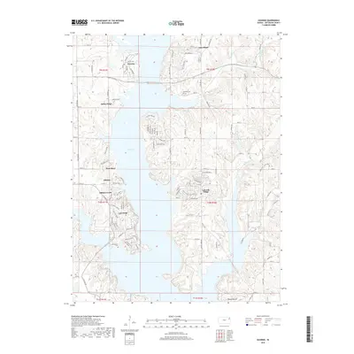
2018 Map of Ozawkie
USGS Topo · Published 2018About this map
Ozawkie sits at the northern edge of Perry Lake, reflecting the contemporary development of Jefferson County as a mix of residential lakeside communities and traditional rural landscapes. The lake's irregular shoreline is punctuated by numerous late-century subdivisions, including Lakeside Village, Hilldale, and Lake Ridge, illustrating the shift toward recreational land use in the region. Despite this modern growth, the area’s agricultural roots remain visible through the grid of county roads and historic sites like Ozawkie Cem and Olive Branch Cem. Natural watercourses such as Slough Creek and Evans Cr continue to feed into the reservoir, while prominent landforms like Round Mound rise above the surrounding terrain. This survey provides a clear view of the area's transition into a residential hub anchored by the large body of water, while still preserving the original township and range structure.
Find a feature on this map
97 named features on this map. Tap any name to fly to it.
Don’t see what you’re looking for? This feature index may not catch every label — zoom into the map to look around manually.
Map Details
Editions of this 2018 Ozawkie Map
This is the sole edition of this map. No revisions or reprints were ever made.
Other maps of this area

1886 · Oskaloosa
USGS Topo · 1:125,000

1888 · Oskaloosa
USGS Topo · 1:125,000

1889 · Topeka
USGS Topo · 1:125,000

1894 · Oskaloosa
USGS Topo · 1:125,000

1894 · Topeka
USGS Topo · 1:125,000

1949 · Williamstown
USGS Topo · 1:24,000

1949 · Perry
USGS Topo · 1:24,000

1950 · Perry
USGS Topo · 1:24,000

1950 · Kansas City
USGS Topo · 1:250,000

1950 · Williamstown
USGS Topo · 1:24,000