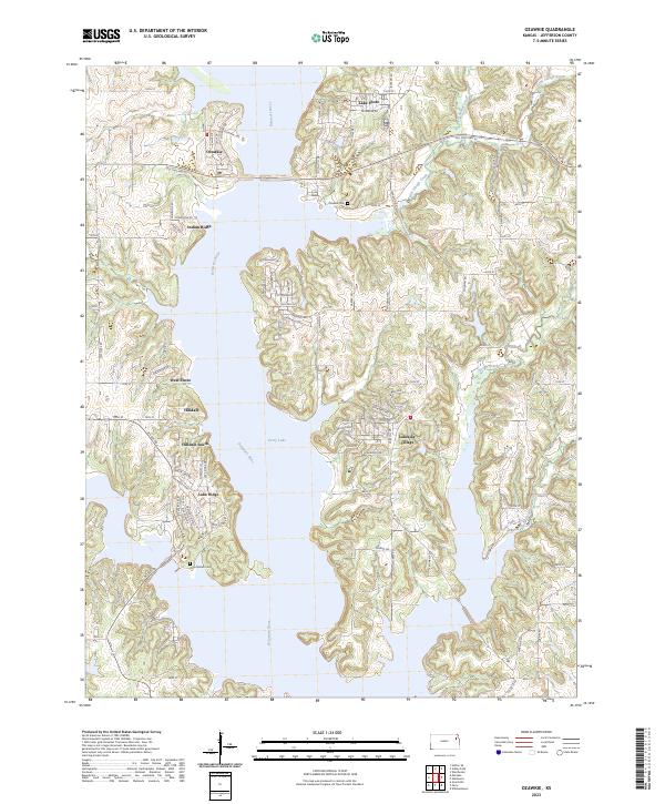
2023 Map of Ozawkie
USGS Topo · Published 2023About this map
Ozawkie and a string of residential lakeside communities define this portion of Jefferson County along the expansive waters of Perry Lake. The landscape is characterized by the drowned valley of the Delaware River, where the rising waters have created a complex shoreline of deep inlets and fingers of land like Indian Ridge. Modern developments such as Lakeside Village, Lake Ridge, and Hilldale South are clustered around these coves, reflecting the area's transition into a recreation-centered region.
Find a feature on this map
118 named features on this map. Tap any name to fly to it.
Don’t see what you’re looking for? This feature index may not catch every label — zoom into the map to look around manually.
Map Details
Editions of this 2023 Ozawkie Map
This is the sole edition of this map. No revisions or reprints were ever made.
Other maps of this area

1886 · Oskaloosa
USGS Topo · 1:125,000

1888 · Oskaloosa
USGS Topo · 1:125,000

1889 · Topeka
USGS Topo · 1:125,000

1894 · Oskaloosa
USGS Topo · 1:125,000

1894 · Topeka
USGS Topo · 1:125,000

1949 · Williamstown
USGS Topo · 1:24,000

1949 · Perry
USGS Topo · 1:24,000

1950 · Perry
USGS Topo · 1:24,000

1950 · Kansas City
USGS Topo · 1:250,000

1950 · Williamstown
USGS Topo · 1:24,000