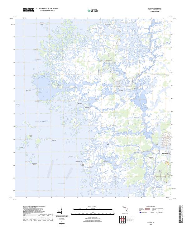
2025 Map of Ozello
USGS Topo · Published 2025About this map
The coastal island community of Ozello anchors this modern topographic survey, illustrating the complex labyrinth of the Florida Gulf Coast. Defined by a dense network of mangroves, tidal creeks, and hammock islands, the landscape is fractured by waterways like the Saint Martins River and Little Homosassa River. The map captures the delicate interface between the Chassahowitzka Swamp and the open Gulf of America, showcasing how development in the village of Homosassa meets the vast wetland systems of Citrus County. Local history is preserved in landmarks such as the Morningwood Cem, while the modern recreational character of the region is evidenced by the Florida Circumnavigational Paddling Trl. This document records a maritime environment where narrow roads like N Ozello Trl provide the only land access to isolated points like Paradise Island and Lashley Point.
Find a feature on this map
78 named features on this map. Tap any name to fly to it.
Don’t see what you’re looking for? This feature index may not catch every label — zoom into the map to look around manually.
Map Details
Editions of this 2025 Ozello Map
This is the sole edition of this map. No revisions or reprints were ever made.
Other maps of this area

1954 · Homosassa
USGS Topo · 1:24,000

1954 · Chassahowitzka Bay
USGS Topo · 1:24,000

1954 · Crystal River
USGS Topo · 1:24,000

1954 · Chassahowitzka
USGS Topo · 1:24,000

1954 · Red Level
USGS Topo · 1:24,000

1954 · Ozello
USGS Topo · 1:24,000

1955 · Plant City
USGS Topo · 1:250,000

1958 · Plant City
USGS Topo · 1:250,000

1959 · Plant City
USGS Topo · 1:250,000

1964 · Plant City
USGS Topo · 1:250,000