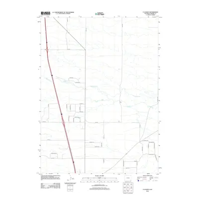
2012 Map of P O Ranch
USGS Topo · Published 2012About this map
P O Ranch serves as a central landmark within this Laramie County landscape, where the High Plains terrain is defined by the winding course of Lodgepole Cr and water management features like North Lodgepole Ditch and Peach Lake. The area's development is notably characterized by a dense cluster of roads with names borrowed from Yellowstone's iconic geography, including Geyser Rd, Mammoth Rd, Fishing Bridge Rd, and Jackson Lake Rd.
Find a feature on this map
40 named features on this map. Tap any name to fly to it.
Don’t see what you’re looking for? This feature index may not catch every label — zoom into the map to look around manually.
Map Details
Editions of this 2012 P O Ranch Map
This is the sole edition of this map. No revisions or reprints were ever made.
Other maps of this area

1911 · Cheyenne
USGS Topo · 1:125,000

1914 · Cheyenne
USGS Topo · 1:125,000

1950 · Cheyenne
USGS Topo · 1:62,500

1954 · Cheyenne
USGS Topo · 1:250,000

1958 · Cheyenne
USGS Topo · 1:250,000

1961 · Round Top Lake
USGS Topo · 1:24,000

1961 · Cheyenne
USGS Topo · 1:62,500

1961 · Cheyenne North
USGS Topo · 1:24,000

1962 · P O Ranch
USGS Topo · 1:24,000
1962 · Farthing Ranch
USGS Topo · 1:24,000