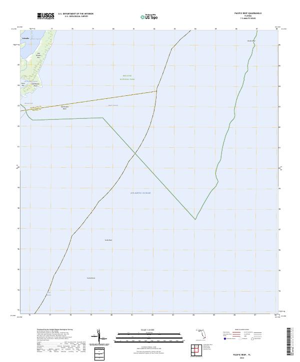
2024 Map of Pacific Reef
USGS Topo · Published 2024About this map
Biscayne National Park protects a vast expanse of the northern Florida Keys, where the transition from shallow lagoons to the open Atlantic Ocean is marked by a string of coral keys and submerged banks. The map highlights the remote settlement of Islandia on Old Rhodes Key, a location that reflects the isolated character of these outer islands before modern development. This maritime landscape is defined by intricate waterways such as Jones Lagoon and Old Rhodes Channel, which weave between mangrove-lined keys.
Find a feature on this map
18 named features on this map. Tap any name to fly to it.
Don’t see what you’re looking for? This feature index may not catch every label — zoom into the map to look around manually.
Map Details
Editions of this 2024 Pacific Reef Map
This is the sole edition of this map. No revisions or reprints were ever made.
Other maps of this area

1947 · Garden Cove
USGS Topo · 1:24,000

1949 · Garden Cove
USGS Topo · 1:24,000

1949 · Elliott Key
USGS Topo · 1:24,000

1949 · Card Sound
USGS Topo · 1:24,000

1949 · Pacific Reef
USGS Topo · 1:24,000

1949 · Arsenicker Keys
USGS Topo · 1:24,000

1956 · Card Sound
USGS Topo · 1:24,000
1956 · Pacific Reef
USGS Topo · 1:24,000
1956 · Elliott Key
USGS Topo · 1:24,000
1956 · Arsenicker Keys
USGS Topo · 1:24,000