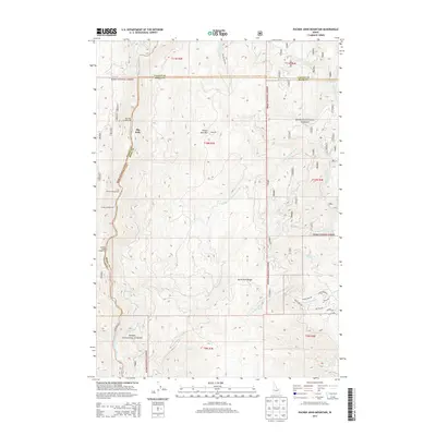
2013 Map of Packer John Mountain
USGS Topo · Published 2013About this map
Packer John Mtn stands as a central landmark in this 2013 survey of the Boise National Forest, marking the high ground between the North Fork Payette River and the tributaries of the Scriver Creek system. The map documents a landscape defined by its timber and recreation value, with several established campsites along the river corridor including Big Eddy Campground, Cold Springs Campground, and Canyon Campground. The presence of the Yank Lad mine near the mountain peak provides a specific point of interest for those researching local mining history and early mountain claims.
Find a feature on this map
58 named features on this map. Tap any name to fly to it.
Don’t see what you’re looking for? This feature index may not catch every label — zoom into the map to look around manually.
Map Details
Editions of this 2013 Packer John Mountain Map
This is the sole edition of this map. No revisions or reprints were ever made.
Other maps of this area

1894 · Squaw Creek
USGS Topo · 1:125,000

1909 · Garden Valley
USGS Topo · 1:125,000

1953 · Smiths Ferry
USGS Topo · 1:62,500

1953 · Boiling Springs
USGS Topo · 1:62,500

1953 · Banks
USGS Topo · 1:62,500

1955 · Baker
USGS Topo · 1:250,000

1957 · Challis
USGS Topo · 1:250,000

1959 · Baker
USGS Topo · 1:250,000

1959 · Garden Valley
USGS Topo · 1:62,500

1960 · Challis
USGS Topo · 1:250,000