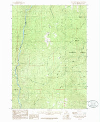
1985 Map of Packer John Mountain
USGS Topo · Published 1986About this map
The North Fork Payette River carves its way through this portion of the Boise National Forest in central Idaho. The terrain is defined by the prominent Packer John Mountain Range, which serves as a significant drainage divide for numerous seasonal and perennial watercourses. The map captures a transition between Valley and Boise Counties, revealing a landscape shaped by narrow canyons and timbered slopes. Along the river, a notable landmark known as Big Eddy provides a specific point of reference for historical river travel and logging operations. A complex web of waterways, including Scriver Creek with its many forks and Howell Creek, underscores the hydrological importance of this area to the larger river system during the mid-1980s.
Find a feature on this map
18 named features on this map. Tap any name to fly to it.
Don’t see what you’re looking for? This feature index may not catch every label — zoom into the map to look around manually.
Map Details
Editions of this 1985 Packer John Mountain Map
This is the sole edition of this map. No revisions or reprints were ever made.
Other maps of this area

1894 · Squaw Creek
USGS Topo · 1:125,000

1909 · Garden Valley
USGS Topo · 1:125,000

1953 · Smiths Ferry
USGS Topo · 1:62,500

1953 · Boiling Springs
USGS Topo · 1:62,500

1953 · Banks
USGS Topo · 1:62,500

1955 · Baker
USGS Topo · 1:250,000

1957 · Challis
USGS Topo · 1:250,000

1959 · Baker
USGS Topo · 1:250,000

1959 · Garden Valley
USGS Topo · 1:62,500

1960 · Challis
USGS Topo · 1:250,000