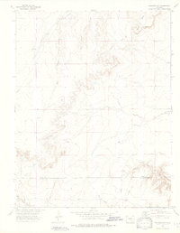
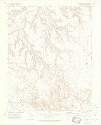
1972 Map of Packers Gap
USGS Topo · Published 1976About this map
Packers Gap and the Shale Hills define the high terrain of this Colorado ranching landscape during the early 1970s. Situated along the boundary of Otero and Las Animas counties, the area is characterized by a complex drainage system including the East Branch Crooked Arroyo and the South Fork Jack Canyon. Human presence is sparse and utilitarian, centered around the Rourke settlement and the nearby Rourke Landing Strip, which speak to the vast distances of the region.
Find a feature on this map
18 named features on this map. Tap any name to fly to it.
Don’t see what you’re looking for? This feature index may not catch every label — zoom into the map to look around manually.
Map Details
Editions of this 1972 Packers Gap Map
4 editions found
Other maps of this area

1891 · Timpas
USGS Topo · 1:125,000

1894 · Timpas
USGS Topo · 1:125,000

1955 · La Junta
USGS Topo · 1:250,000

1958 · La Junta
USGS Topo · 1:250,000

1965 · La Junta SW
USGS Topo · 1:24,000

1966 · La Junta SE
USGS Topo · 1:24,000

1968 · La Junta
USGS Topo · 1:250,000

1972 · Packers Gap
USGS Topo · 1:24,000
1972 · Stage Canyon
USGS Topo · 1:24,000
1972 · Beaty Canyon
USGS Topo · 1:24,000