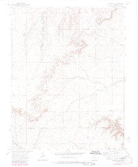
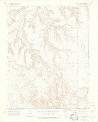
1972 Map of Packers Gap
USGS Topo · Published 1985About this map
Rourke Ranch sits as the primary point of settlement in this arid reach of the Colorado high plains, situated near the boundary between Otero County and Las Animas County. The landscape is defined by an intricate network of erosional features, including the West Branch and East Branch Crooked Arroyo, which carve through the Shale Hills and south toward the deep incisions of Bent Canyon. Infrastructure in this remote area is sparse, primarily serving ranching operations and utility transport, as evidenced by a pipeline cutting across the northwestern corner and the Rourke Landing Strip providing aerial access to the ranch. Natural water sources like the Spring and man-made landmarks such as Honey Windmill and various unnamed wells highlight the essential nature of water management in this environment. The passage through Packers Gap and the presence of numerous jeep trails indicate a region where travel is constrained by the rugged drainages of Minnie Canyon and Iron Canyon.
Find a feature on this map
17 named features on this map. Tap any name to fly to it.
Don’t see what you’re looking for? This feature index may not catch every label — zoom into the map to look around manually.
Map Details
Editions of this 1972 Packers Gap Map
4 editions found
Other maps of this area

1891 · Timpas
USGS Topo · 1:125,000

1894 · Timpas
USGS Topo · 1:125,000

1955 · La Junta
USGS Topo · 1:250,000

1958 · La Junta
USGS Topo · 1:250,000

1965 · La Junta SW
USGS Topo · 1:24,000

1966 · La Junta SE
USGS Topo · 1:24,000

1968 · La Junta
USGS Topo · 1:250,000

1972 · Packers Gap
USGS Topo · 1:24,000
1972 · Stage Canyon
USGS Topo · 1:24,000
1972 · Beaty Canyon
USGS Topo · 1:24,000