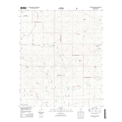
2013 Map of Packsaddle Canyon
USGS Topo · Published 2013About this map
Anderson Ranch sits in the northern reaches of this high-desert landscape, where the Lincoln National Forest meets the northern edges of the Guadalupe Mountains. This 2013 survey illustrates a region defined by its critical water management infrastructure, essential for ranching and survival in the arid terrain of Otero County. The map is densely marked with diverse water storage solutions, ranging from natural features like Hog Lake and the Freeman Waterhole to engineered sites such as Chimney Reservoir Number One and the Wildhorse Mesa Water Storage Tank.
Find a feature on this map
52 named features on this map. Tap any name to fly to it.
Don’t see what you’re looking for? This feature index may not catch every label — zoom into the map to look around manually.
Map Details
Editions of this 2013 Packsaddle Canyon Map
This is the sole edition of this map. No revisions or reprints were ever made.
Other maps of this area

1943 · Texas Hill
USGS Topo · 1:62,500

1945 · Texas Hill
USGS Topo · 1:62,500

1954 · Carlsbad
USGS Topo · 1:250,000

1958 · Carlsbad
USGS Topo · 1:250,000

1963 · Gowdy Ranch
USGS Topo · 1:24,000

1963 · Panama Ranch
USGS Topo · 1:24,000

1965 · Bullis Spring Ranch
USGS Topo · 1:24,000

1978 · Strychnine Draw
USGS Topo · 1:24,000

1978 · Artesia
USGS Topo · 1:100,000
1978 · South Taylor Tank
USGS Topo · 1:24,000