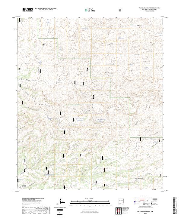
2023 Map of Packsaddle Canyon
USGS Topo · Published 2023About this map
Lincoln National Forest land dominates this high-altitude landscape in Otero County, where a network of canyons and draws defines the rugged terrain of the Guadalupe Mountains. The geography is shaped by water management in a semi-arid environment, evidenced by numerous named tanks and catchments such as Post Tank, Anderson Tank, and the dual Chimney Reservoir Number One and Chimney Reservoir Number Two. These water sources were vital for the ranching operations that utilized primitive routes like Acrey Allot and Mule Deer.
Find a feature on this map
47 named features on this map. Tap any name to fly to it.
Don’t see what you’re looking for? This feature index may not catch every label — zoom into the map to look around manually.
Map Details
Editions of this 2023 Packsaddle Canyon Map
This is the sole edition of this map. No revisions or reprints were ever made.
Other maps of this area

1943 · Texas Hill
USGS Topo · 1:62,500

1945 · Texas Hill
USGS Topo · 1:62,500

1954 · Carlsbad
USGS Topo · 1:250,000

1958 · Carlsbad
USGS Topo · 1:250,000

1963 · Gowdy Ranch
USGS Topo · 1:24,000

1963 · Panama Ranch
USGS Topo · 1:24,000

1965 · Bullis Spring Ranch
USGS Topo · 1:24,000

1978 · Strychnine Draw
USGS Topo · 1:24,000

1978 · Artesia
USGS Topo · 1:100,000
1978 · South Taylor Tank
USGS Topo · 1:24,000